Q. When is a “walk in the Park” not a walk in the park? A. When you have to ascend 1716m and complete the Whisky Trail in Fiordland.
This was a “warm down” tramp after Mt Titiroa. Five of us caught Neil’s transport to the divide where we were left in cloud and light drizzle going in the opposite direction to the crowds on the Routeburn. But the crowds were left behind us as we turned off for Key Summit. I have been up here on a clear day and what spectacular views are to be had, but it was not so today. As we ascended into the wind and rain we got out our jackets, but not for long. There was a very brisk Northerly blowing that pushed us up the hill. Leaving the Key Summit boardwalks there is a distinct track, but no markers or any other indication of the route ahead through the tussock. From 913m at Key the ridge rises and at times falls to the South but has a way of hiding its path. You don’t know whether to head for the top of the next rise or to sidle around hoping not to lose too much of the height gained. It was definitely energy sapping but we were rewarded with increasing vistas as the cloud lifted and was then blown away. On our left, first Lake Howden and then Lake McKellar to be followed by the length of the Greenstone Valley. On our right Lake Gunn and Lake Fergus backed by innumerable Fiordland snow-capped peaks. 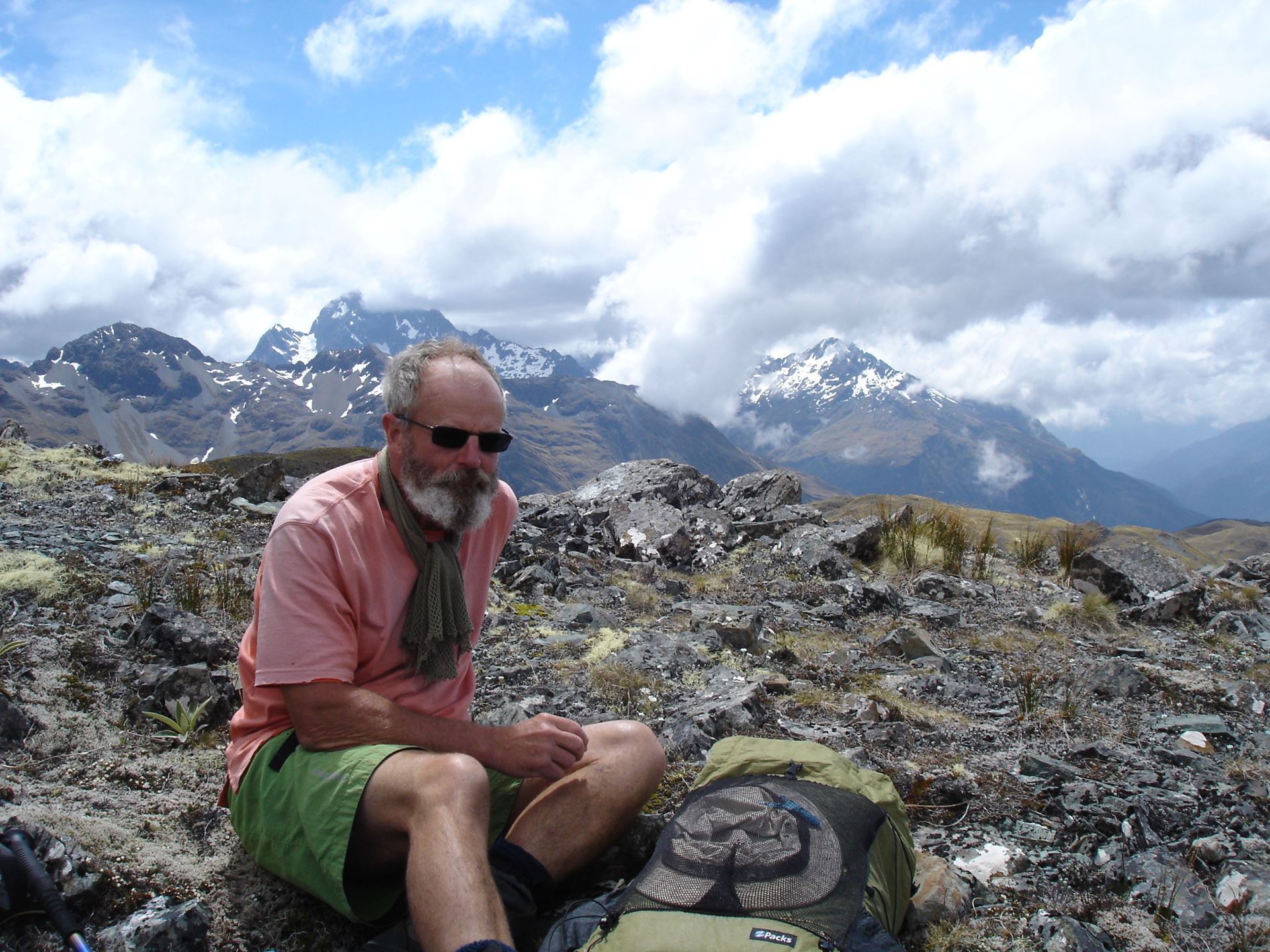
The high point on the day was Pt1543m. I said to the others that we would drop the packs on the col to the east of the summit and do the scramble up to the cairn from there. Now it was blowing big-time and weight becomes an advantage. Not often I can say that! Photos snapped we picked up the packs again and descended precipitously east to the watershed. I wouldn’t be too sure in a white-out but on this clear day we found our route easily off the tops, avoiding some bluffs that would trap some. Soon a track appeared, and we regained the bush of mountain beech. With a total descent time of an hour we made our way safely down to the palatial McKellar Hut. Total time was 7¾hr from the Divide.
The second day was a cruisy 3 hours back along the main highway of the Greenstone to Lake Howden hut and on to the Divide. For further reading and map we were using the Wilderness magazine “McKellar Hut via Key Summit” rated as moderate with 23.4km. I reckon moderate is an average of strenuous (day 1) and easy (day 2). Why “Whisky Trail”? That’s what the DOC ranger at McKellar said to call it and he also said it was a lot easier in reverse direction. Needless to say, we didn’t try that on day 2.
Thanks to the other 4 members of the group for variously providing laughs, company and being led astray.