This tramp was scheduled for Easter 2020 but had to be postponed due to the Covid-19 lockdown.
As on our last trip to the island three years ago, we chartered two boats from Hauraki Express, each with a capacity of twelve passengers. We left in calm, fine conditions and anticipated a fast passage but encountered a heavy swell from Cape Colville. Two eight-seater vans were ready for us at Tryphena and carried the out party to Okupu, on the west coast of the island.
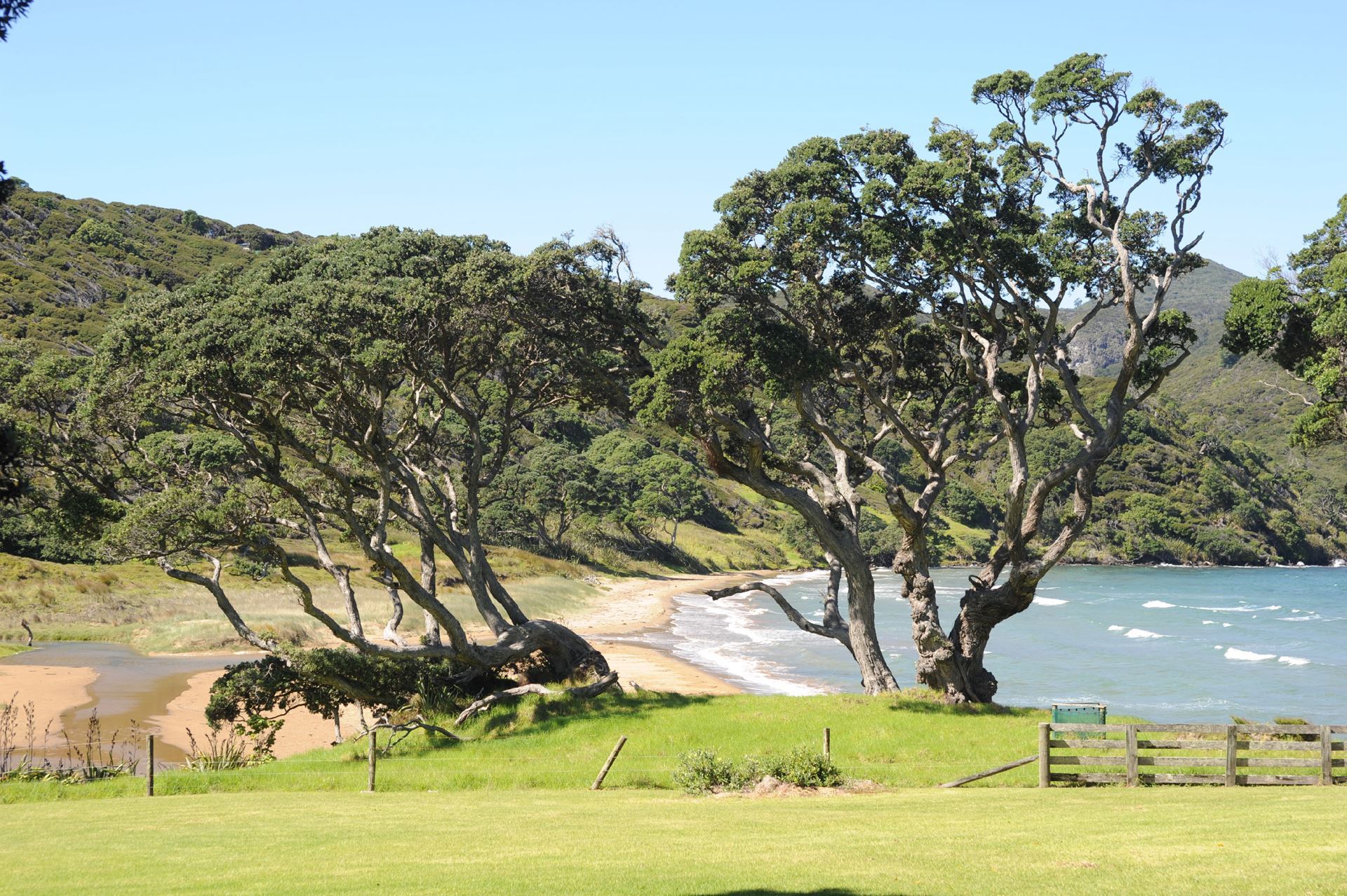
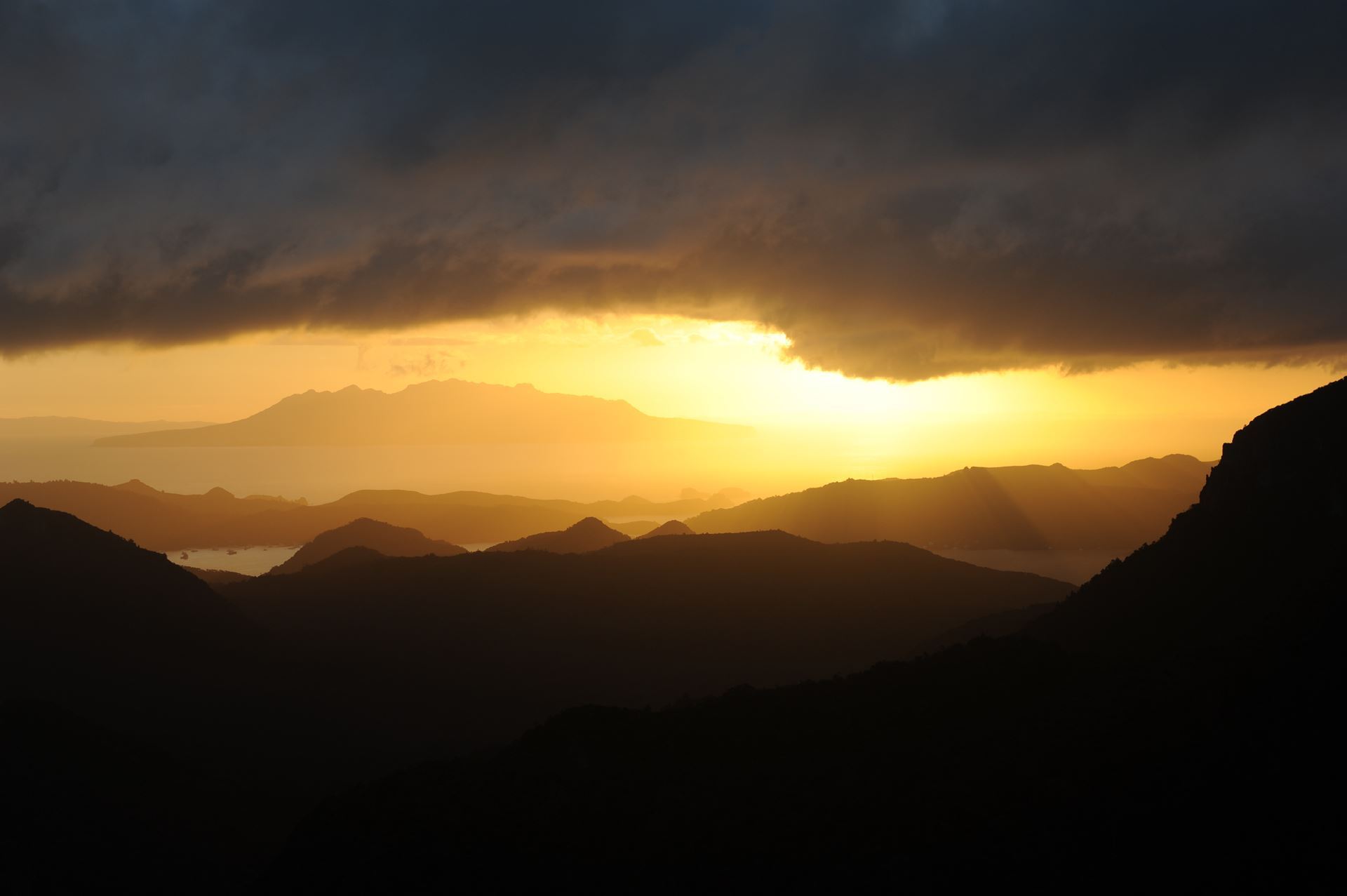
We had lunch on the grass overlooking the beach – an idyllic spot. A brisk breeze blew in from the sea, and the angle of the surrounding trees indicated that this was probably constant. We then walked up the road for a kilometre or two and turned left onto the Te Ahumata Track.
There was a steady climb in warm, humid conditions and when we came to the turn-off for Te Ahumata peak (398m) only a few of the party chose to walk to the summit which seemed to tower above us. They reported that the climb was easier than it looked, with outstanding views. We reached the Whangaparapara Road, walked down to the sea and for a couple of hundred meters along the Old Mill Track to the Green campsite. This was a lovely spot, right next to the sea; when the tide came in, in the middle of the night, it sounded as if the waves were breaking only inches from our tents.

Next morning, we set off northwards along the tramline track, which has been up-graded to Great Walk standard. Here I had a reminder that it is always wise to refer to the most recent maps available. We were looking out for the Pack Track on our left and were surprised to reach the Forest Road. There have been many developments on the island in recent years, some tracks have been upgraded and others – such as the Pack Track – have been abandoned. It did not make much difference, we followed the Forest Road to Maungapika (280m) – this time everyone made the ascent – and turned off to the left, following the Kiwiriki Track.

We dropped down to Kiwiriki Bay and had our lunch at a picturesque spot where Pohutukawas leaned out over the sea. To reach the next bay we had to walk over two hills, each of about 200m. This was no great height, but the steady uphill climbs in warm, humid weather tested our fitness.
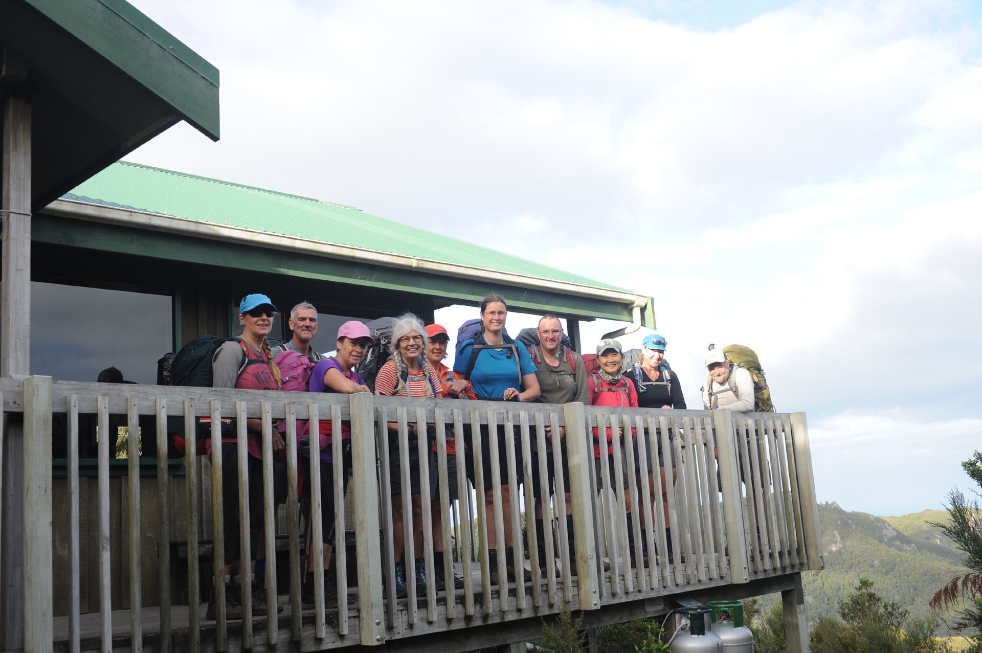
Several boats were moored in Kaiaraara Bay and when we saw a small zodiac heading towards us, some of the more optimistic spirits speculated that they might have been bringing us a case of chilled beer – alas, a fantasy. It was late afternoon when we reached the Kaiaraara Hut – apparently a second bunkroom had been added to make a total of 24 bunks, but there was no capacity to enlarge the cooking and dining area which became very congested.
Next morning – Easter Sunday – we crossed a high swing-bridge – right for the most direct route to Mt Hobson (Hirakimata), left for the coastal footpath to Port Fitzroy. Our hopes of enjoying coffee and croissants in a café there were dashed – everything was closed. One of the party decided to transfer to the home party; we were struggling to make contact with the other party when most of our cell phones were displaying ‘no service’ when, with excellent timing, the airport shuttle happened to pass by.
We walked about two kilometres up the road and turned right onto the Coopers Castle route – one track which has not been upgraded, but still perfectly satisfactory. The initial climb was not too brutal. We followed a ridge line, ascending a series of small peaks then dropping down again before climbing up the next.
At last, we reached Coopers Castle (465m) itself, with extensive views over Okiwi and Whangapoua Beach to the north. It was not a place for those prone to vertigo – we were on the edge of a vertical drop of a couple of hundred meters. We had lunch there and spoke to Imogen, whose group was enjoying their lunch on the summit of Mt Hobson, two kilometres away.
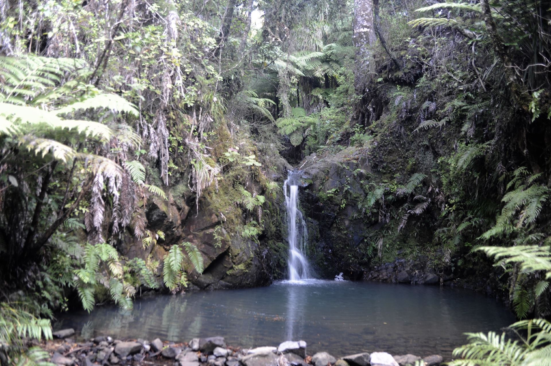
Mt Hobson is only 150m higher than Coopers Castle but it was not to be so easy – we had a precipitous descent of perhaps 250 meters before we started climbing again. At least we dropped far enough to find a stream which was good news for those whose water bottles were nearly empty. We passed a kauri dam, and then started climbing. We soon reached the bottom of the notorious stairs, which seemed to go on forever. How many are there? Perhaps two or three thousand.
There is a track junction, where the Kaiaraara Track meets Palmers Track coming from the left and South Fork Track on the right – from here it was only another five minutes to the summit. The summit did not disappoint – there was excellent visibility and a faint breeze which was refreshing but did not freeze us. One or two people even commented that it had been worth all the pain.
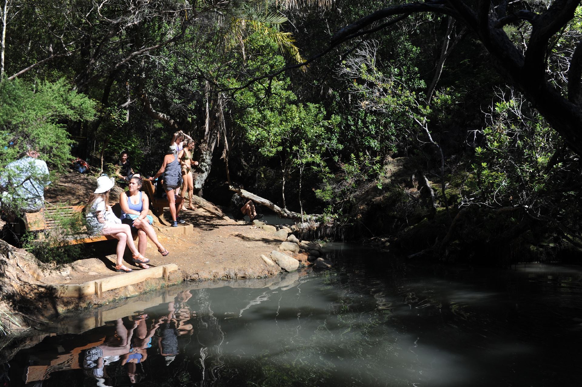
 Our fourth and final day began with an easy walk downhill of about two hours to the Kaitoke Hot Springs. This is the perfect way to relax after the strenuous activity of the past three days, and we soaked there for more than an hour. Another 45 minutes’ walk through the wetlands brought us to the end of our tramp.
We were fortunate that both our vehicle and our boat came earlier than scheduled – we left Tryphena at 2.30 pm rather than 4 pm, and had a very rough ride back to Auckland.